What a Spectacular Location to Build House!
Few days ago, I was traveling between sites. I noticed a landslide with a house on it and took a closer look.

Looks like during construction phase of the house that landslide had occurred and due to this reason, construction of house has not been completed and abandoned. It seems to me the displacement has took place recently because backscarp is quite fresh and there is new houses next to abandoned one with same design.
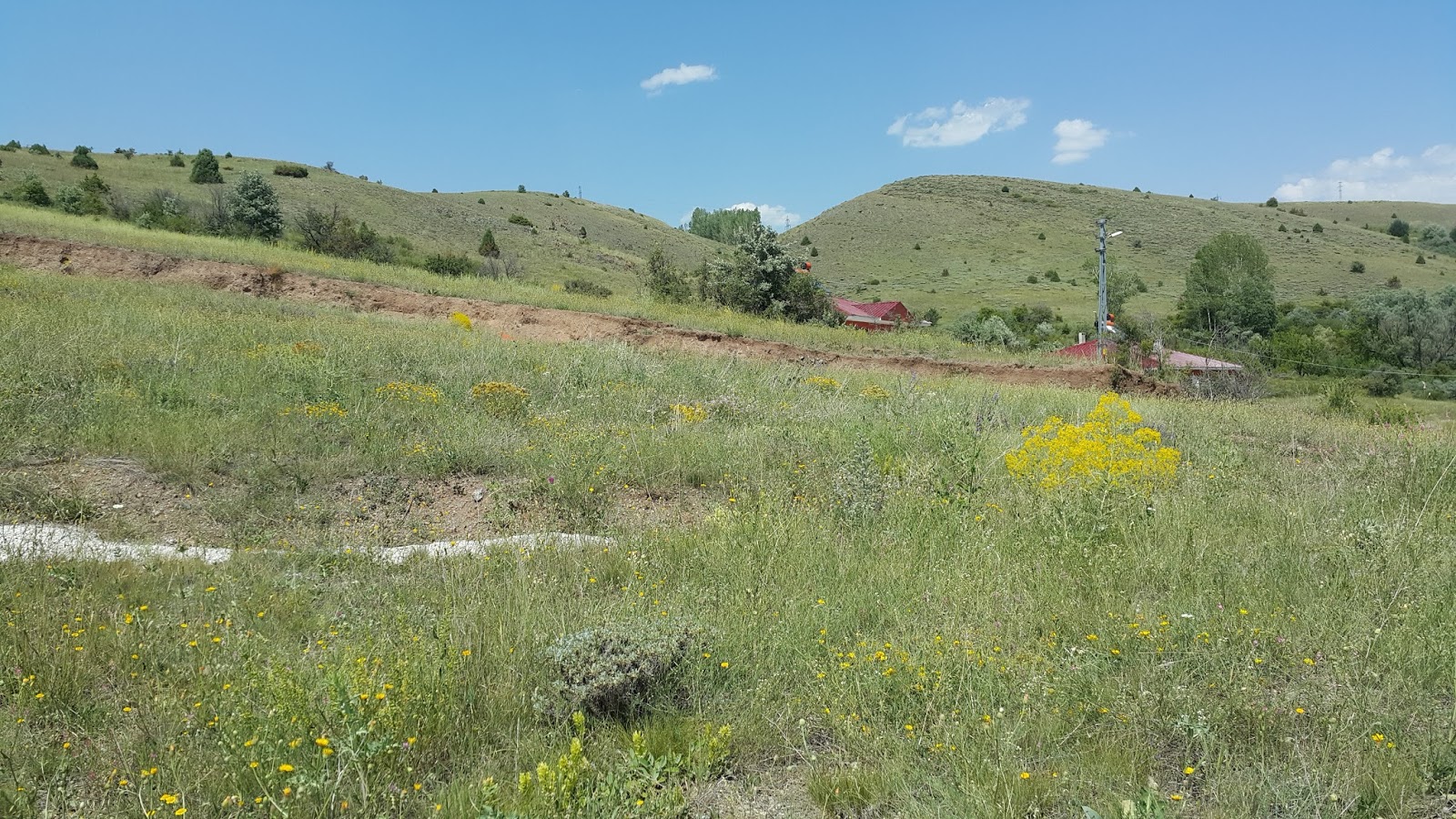
There was some surface drainage and slope rehabilitation into and next to landslide which is constructed to mitigate slope movement likely. So, should be slope movement problem previously. I checked satellite imagery for previous situation of the location.

Imageries are taken from Google Earth. Imagery on the left-hand side is taken on October 2009 and failed mass can be seen clearly. I could not find a detail for when was the failure but it is obvious that triggered by road cut.
Imagery on the right-hand side is taken on August 2016. After removing of the failed mass, highway directorate had constructed surface drainage (seem as white lines) and benches to mitigate landslide. By looking the displacement on the upper surface drainage line we know that failure occurred after rehabilitation works.
Let's do some brainstorming and try to estimate the reason of the displacement.
We have two mass movements, one is previous and other one is recent and affecting the house construction. Moving material for both movement is mixture of gravel-sand-silt and clay, can be defined as "Loose slightly gravelly silty/clayey sand". I am not sure about the thickness of this layer but about 4m on upper side and getting thinner downward. As it can be seen in the second satellite imagery this layer is underlie by magmatic rocks (grayish color rock is part of ophiolite which is common in this area).
The width of the previous mass movement is about 100m and length is about 150-180m. There is not any sign of deformation (accumulation) at the south side of the road. Therefore most likely road cut cause the previous mass movement and by looking shape and deformation pattern of the failed mass from imagery it looks like a translational slide which is failed from contact of the soil and rock.
I think the failure mechanism of the recent failure is same with previous one but this mass is not failed totally like previous one. It is just started and most likely continuing. Let's sort what we have about recent failure;
- There is a cut about 3-4m height to construct smooth base for foundation.
- About 1m displacement occurred. It can be seen on uppermost drainage line.
- Failed mass is Loose silty/clayey SAND. (non-cohesive or slightly)
- No back-tilting at head of landslide.
- No accumulation or deformation evidence on downward side of the house.
- The direction of movement head to directly to the cut of the house construction.
As a result, by using these inferences I can say; steep cut on house construction create a 3-4m height unsupported face. With low shear strength of the soil, all mass started to move downward. It is translational slide and active. Displacement rate controls with precipitation and total failure has not occurred yet.
Comments
Post a Comment